Read the transcript
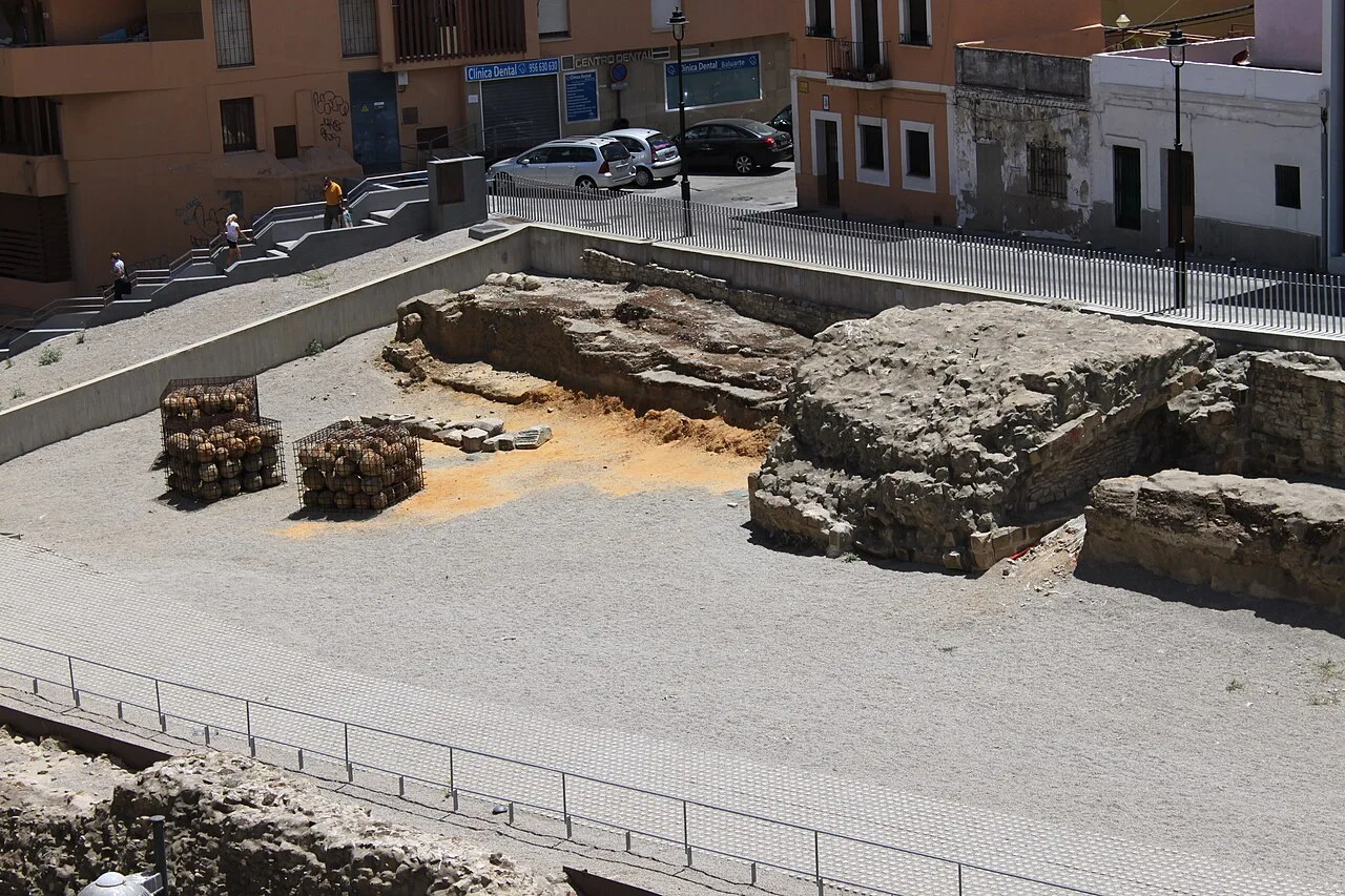
Among today's streets, a different Algeciras appears: a city that needed to control its entrances, defend its port and negotiate its place between two shores. The medieval walls are not a backdrop for a quick photograph. They invite you to imagine crossing an urban boundary when a gate had military importance. The surviving complex belongs to the Marinid fortification built between 1279 and 1285. Its remains reveal stretches of wall, towers, an outer wall and a moat, as well as the entrance associated with the Puerta del Fonsario. The name refers to the cemetery outside the enclosure. The destruction of the city in the fourteenth century and the later reoccupation of its site explain why we now read the defensive system through fragments and excavations. Begin by looking at the distance between the wall and the moat. Then identify the changes of direction in the approach: what matters is not just a wall's height, but how it controls the movement of someone trying to enter. Compare the remains with the level of modern streets to perceive the layering of cities. Follow the panels and distinguish original remains from later presentation work. The municipal walk connects the Alfonso XI area with Avenida Virgen del Carmen. Explore the designated areas and check the interpretation centre's opening times if you want to extend the visit. From here, Plaza Alta forms a logical continuation through the city; the contrast between medieval fortification and modern square is one of the best introductions to local history.
La historia que guarda este lugar
Entre las calles actuales aparece una Algeciras distinta: la ciudad que necesitaba controlar sus entradas, defender su puerto y negociar su lugar entre las dos orillas. Las murallas medievales no son un fondo para una foto rápida. Son una invitación a imaginar cómo se atravesaba una frontera urbana cuando una puerta tenía valor militar.
El conjunto conservado corresponde a la fortificación meriní levantada entre 1279 y 1285. Sus restos permiten reconocer lienzos, torres, antemuro y foso, además del acceso relacionado con la Puerta del Fonsario. El nombre alude al cementerio situado fuera del recinto. La destrucción de la ciudad en el siglo XIV y la posterior reocupación de su solar explican que hoy leamos el sistema defensivo a través de fragmentos y excavaciones.
Detente, mira, descubre
Empieza mirando la distancia entre la muralla y el foso. Después identifica los cambios de dirección del acceso: lo importante no es solo la altura de un muro, sino cómo condiciona el movimiento de quien intenta entrar. Compara los vestigios con el nivel de las calles modernas para percibir la superposición de ciudades. Sigue los paneles y distingue restos originales de intervenciones de presentación.
Cómo disfrutar la visita
El paseo municipal vincula el entorno de Alfonso XI con la avenida Virgen del Carmen. Recorre las zonas habilitadas y consulta la apertura del centro de interpretación si deseas ampliar la visita. Desde aquí, Plaza Alta queda integrada en una continuación urbana lógica; el contraste entre fortificación medieval y plaza moderna es una de las mejores introducciones a la historia local.
Fuentes para conocer más
Descúbrelo dentro de un recorrido
Algeciras monumental, paso a paso →
The medieval walls introduce Algeciras’s defensive history within the modern city. Archaeological remains help explain the relationship between gateways, towers and the settlement; use the site’s interpretation to place what you see in context.
What to look out for
- Archaeological site
- Medieval defences
Planning your visit
Check opening arrangements before planning your visit; a map marker does not guarantee indoor access.
The map
Approximate place locations, not hiking tracks.
Before you go
Check the official source for current access and conditions.
Confirm access, opening hours and conditions with the official source. Follow signs and check restrictions in natural areas. We do not offer verified GPX tracks.
Sources consulted
www.algeciras.es ↗Sources reviewed · 2026-09-12