Read the transcript
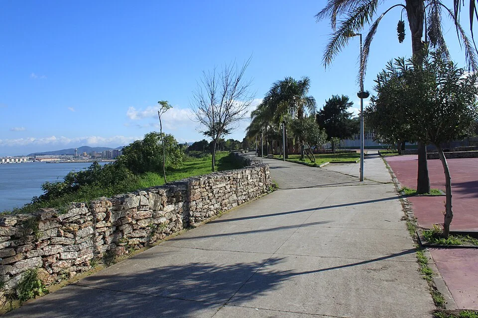
Paseo de Cornisa changes your viewpoint on Algeciras: it invites you to follow the city's edge and understand that the bay's landscape is also part of its heritage. It is a walk for looking far and near, alternating the horizon with the urban traces accompanying the route. The municipal route connects Avenida Juan Pérez Arriete with the Rinconcillo and La Concha area. Alongside green spaces and facilities survive the remains of Torrealmirante, known as the Polvorín tower, testimony to coastal defence. The local description also records its use as an observation and machine-gun position during the Civil War. The contrast between today's promenade and that earlier military function adds depth to the visit. Seek designated points where the perspective of the bay changes, without approaching unsafe edges. When you encounter the defensive remains, observe their relationship with the water: their location helps explain their function. The idea is not to imagine an empty coast, but to see how city, port activity and walking spaces coexist in a single landscape. Plan the route as a separate outing towards La Concha, allowing time to return. If connecting it with the centre, add the urban approach and always use pavements and designated crossings. This is not a mountain trail and does not guarantee direct access to every waterside point. Adapt the distance to the wind, heat and needs of your group.
La historia que guarda este lugar
El Paseo de Cornisa cambia el punto de vista sobre Algeciras: invita a seguir la ciudad por su borde y a entender que el paisaje de la bahía también forma parte de su patrimonio. Es un paseo para mirar lejos y cerca, alternando el horizonte con las huellas urbanas que acompañan el recorrido.
El trazado municipal conecta la avenida Juan Pérez Arriete con el entorno del Rinconcillo y La Concha. Junto a sus espacios verdes y equipamientos sobreviven los restos de Torrealmirante, conocida como torre del Polvorín, testimonio de la defensa del litoral. La ficha local recoge también su uso como posición de observación y ametralladoras durante la Guerra Civil. Ese contraste entre paseo actual y función militar anterior añade profundidad a la visita.
Detente, mira, descubre
Busca los puntos habilitados desde los que cambia la perspectiva de la bahía, sin acercarte a bordes inseguros. Cuando encuentres los restos defensivos, observa su relación con el agua: el emplazamiento explica parte de su función. La propuesta no consiste en imaginar una costa vacía, sino en mirar cómo conviven ciudad, actividad portuaria y espacios de paseo en un mismo paisaje.
Cómo disfrutar la visita
Plantea el trayecto como una salida propia hacia La Concha, con tiempo para regresar. Si lo enlazas con el centro, añade el desplazamiento urbano y sigue siempre aceras y cruces habilitados. No es una senda de montaña ni garantiza acceso directo a todos los puntos del agua. Adapta la longitud al viento, al calor y a las necesidades del grupo.
Fuentes para conocer más
Paseo de Cornisa follows Algeciras’s urban waterfront. The bay accompanies the walk, offering a different perspective from the central streets and revealing how closely the sea is woven into the city’s everyday landscape.
What to look out for
- Urban waterfront
- Bay views
Planning your visit
Confirm conditions with the venue or operator before booking or travelling.
Before you go
Check the official source for current access and conditions.
Confirm access, opening hours and conditions with the official source. Follow signs and check restrictions in natural areas. We do not offer verified GPX tracks.
Sources consulted
www.algeciras.es ↗Sources reviewed · 2026-09-12